(Click here for more photographs.)
Turning south, we moved on to Montrose, located about 15 miles from Black Canyon of The Gunnison National Park. In Montrose we parked at Cedar Creek RV Park.
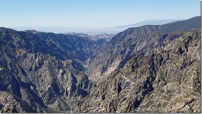
Two million years ago, water that would eventually become the Gunnison River, began to cut through a portion of the Gunnison Uplift. What we see now in the canyon is the 2 billion year old rock exposed by the many years of erosion. The canyon is 48 miles long and within the canyon, the Gunnison River drops an average of 43 feet per mile. The depth of the canyon walls ranges from 1,100 feet to over 2,700 feet. For many years the canyon resisted all efforts at human exploration. There are longer and deeper canyons but few can match the combination of depth, narrowness and sheer canyon walls of the Black Canyon.
We took a day trip south of Montrose to the town of Ouray, which bills itself as “Switzerland of America” and it’s easy to see why. The town is surrounded by some of the most beautiful mountain scenery imaginable. These mountains were extensively mined during the mid to late 1800’s. An extensive network of crude roads which were originally developed in order to reach the mines, crisscross the mountains. We took a jeep tour that took us up one of these roads to reach the Imogene Pass at 13,144 feet. This road was extremely rough in places and definitely accessible only with 4 wheel drive, high clearance vehicles. About 6 miles down the other side of Imogene Pass is the Telluride Ski resort.
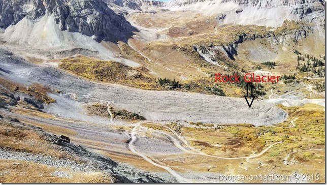
Near the summit, our guide pointed out an interesting geological formation that we had never encountered. It’s called a “rock glacier”, consisting either of angular rock debris frozen in interstitial ice, a former true glacier overlain by a layer of talus, or something in between. Rock glaciers are typically tongue shaped (as you can see in the above photo) and as with true glaciers, rock glaciers move downslope.
Next stop: Durango, CO

